
Resilient Water Solutioning& Resource Management.
At Senergy we apply engineering precision and advanced data analytics to complex industrial and municipal water challenges, drawing on cross-sector expertise — including oil and gas engineering insight into produced-water management. Our services integrate innovative solutions to ensure sustainability and efficiency.
Five water disciplines, one holistic approach.
Water resource exploration & development
We identify sustainable freshwater and groundwater sources using AI-driven analytics for efficient exploration, then develop resilient water-supply systems with smart infrastructure to secure long-term availability.
Industrial water & wastewater treatment
We design, optimise and troubleshoot treatment for complex water streams from refineries, chemical plants and power generation, leveraging oil and gas produced-water expertise to enhance outcomes.
Municipal water advisory
Consulting on resource management, optimisation of treatment infrastructure and implementation of smart water networks that support resilient municipal systems.
Water reuse & resource recovery
Strategies for water recycling and for recovering valuable resources — nutrients and energy — from wastewater, promoting circular water economies.
Digital water solutions
Sensors, data analytics and AI from our AID pillar enable leak detection, network optimisation, predictive quality monitoring and improved operational efficiency.
This holistic approach ensures sustainable water management tailored to evolving needs.
- Introduction
- The megawatershed concept
- Case study
- Multi-disciplinary workflow
- Exploration drilling
- Discovery
- Sustainable development
- Your partner
Unlocking deep freshwater resources: a paradigm shift in water exploration.
Introduction
Water scarcity is a growing global crisis, exacerbated by climate change, population growth and unsustainable water-management practice. Traditional surface-water resources are increasingly stressed, demanding innovative approaches to secure reliable and sustainable supply. Senergy Ltd is at the forefront of this innovation, providing resilient water solutions through the application of cutting-edge geoscience and engineering expertise. This paper sets out our proven capability in identifying and developing unconventional deep underground freshwater resources, drawing on a successful pioneering project in a challenging Middle Eastern environment.
The megawatershed concept: a new frontier in water exploration
Conventional water exploration focuses on shallow alluvial aquifers. Yet vast quantities of freshwater can be trapped in deeper geological formations, often recharged from distant mountainous regions through intricate subsurface flow paths. The "megawatershed" theory holds that meltwater from high-altitude snow and rainfall can penetrate deep into fractured and porous rock, travelling significant horizontal distances over geological timescales. These deep aquifers can discharge as sea-bottom freshwater springs or accumulate in structurally controlled basins.
Overcoming geological uncertainty: a case study in the Middle East
Our co-founder led a groundbreaking project in a Middle Eastern region characterised by significant geological uncertainty after decades of conflict and limited data availability. The objective was to explore for deep underground freshwater based on the megawatershed concept and to address severe drought conditions affecting the local population. The available data was sparse:
- Limited 2D seismic lines (1980s vintage) — rudimentary structural insight.
- Recently acquired magnetotelluric (MT) lines — subsurface resistivity variations, potentially indicative of fluid content and lithology.
- Satellite imagery — a broad overview of surface features and potential recharge zones in distant mountains.
A multi-disciplinary approach to resource identification
- Satellite image interpretation: identifying potential recharge areas in the distant mountains and mapping the major structural features that could influence subsurface flow.
- 2D seismic interpretation and depth conversion: delineating subsurface structures, identifying potential reservoir horizons and estimating depth, with advanced depth-conversion techniques that acknowledge the inherent uncertainty.
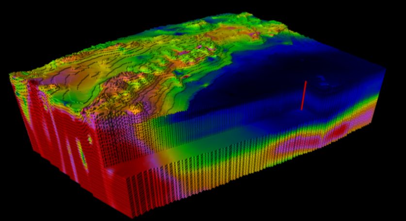
- Integration with MT data: high-resistivity zones indicating resistive bedrock; lower-resistivity zones associated with conductive fluids such as freshwater or saline formations — integrated with the seismic interpretation to constrain the geological model and identify potential freshwater-bearing aquifers.
- Conceptual geological model: outlining the pathways for deep-water migration from recharge areas to the basin and the trapping mechanisms within porous and permeable formations.
- Seismic sequence stratigraphy and lithology prediction: interpreting depositional sequences to identify reservoir and non-reservoir units and building a predictive lithology model for the rock types and properties expected at depth.

Targeted exploration drilling: validating the conceptual model
The subsurface studies culminated in the selection of a high-potential location for a wildcat exploration well. A comprehensive well prognosis set out anticipated lithologies, depths of potential freshwater zones and likely drilling challenges. Crucially, pore-pressure and fracture-gradient predictions were made despite the absence of deep well data in the region.
The well basis of design was developed with an experienced drilling team, and a dedicated project team of drilling and subsurface experts was assembled. The operation reached a total depth of 3,000 metres in a remarkable 60 days — a record for the country, where similar wells in more mature basins typically took six months. This efficiency underscored the accuracy of the pre-drilling planning and the effectiveness of the integrated team approach.
Discovery and resource characterisation
The wildcat well intersected multiple zones containing significant volumes of freshwater. The lithological predictions proved highly accurate, validating the integrated workflow, and the predicted pore pressure and fracture gradient were remarkably consistent with the downhole measurements. Geochemical analysis of recovered samples confirmed the megawatershed theory: the water originated from high-altitude mountain snowmelt that had travelled deep subsurface pathways. Suitable for irrigation as produced, it required desalination for potable use.
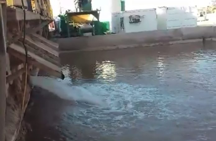
Four wells have since been drilled in the basin — all successfully encountering freshwater. A reverse-osmosis plant now pumps desalinated water into the drinking-water system of a nearby city, reversing out-migration from a drought-stricken region.
Sustainable water resource development
The exploration success paved the way for a comprehensive development plan. Full-field geological and simulation models were built to optimise well placement and predict long-term water production. This project represents a milestone in targeted freshwater exploration: unlike earlier deep-freshwater discoveries, which were often accidental, it demonstrated the feasibility of a scientifically driven approach based on the megawatershed concept and integrated geoscience. Deep aquifers often hold far larger volumes than shallow alluvial systems and are less susceptible to surface contamination and short-term climate variability.
Senergy Ltd: your partner in unlocking deep water resources
- Integrated geoscience interpretation — satellite imagery, 2D and 3D seismic, magnetotellurics and other geophysical and geological datasets combined into robust subsurface models.
- Megawatershed analysis — identifying deep-water recharge zones and flow pathways.
- Seismic sequence stratigraphy and lithology prediction — accurately predicting subsurface lithologies and reservoir characteristics.
- Pore-pressure and fracture-gradient prediction — crucial for safe and efficient drilling.
- Well planning and drilling supervision — efficient, cost-effective drilling programmes.
- Hydrogeological characterisation and reservoir modelling — water quality, quantity and long-term production potential.
- Development planning and water-management solutions — sustainable extraction and distribution systems.
The successful exploration and development of deep underground freshwater in the Middle East demonstrates a paradigm shift in the approach to water security. Senergy Ltd has the expertise to replicate this success in other water-stressed regions worldwide — unlocking vast, previously untapped freshwater reserves for communities and industries.